
COMMUNITY NOTICE: LOW-LEVEL US GEOLOGICAL SURVEY FLIGHTS EXPECTED THIS SUMMER
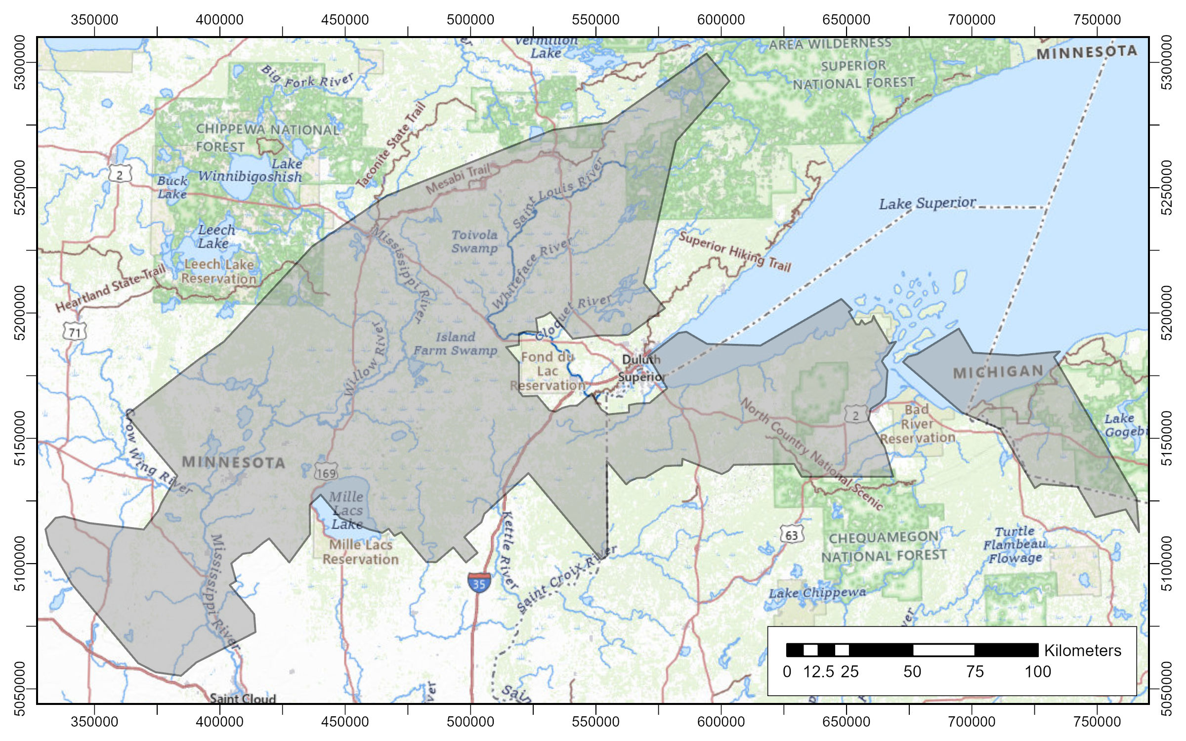
Map showing the location of the survey over Michigan, Wisconsin, and Minnesota. The survey will cover parts of Gogebic and Ontonagon counties in Michigan, Ashland, Bayfield, Douglas, Iron, and Vilas counties in Wisconsin, and, Benton, Carlton, Cass, Crow Wing, Douglas, Itasca, Kanabec, Lake, Mille Lacs, Morrison, Otter Tail, Pine, St. Louis, Stearns, Todd, and Wadena counties in Minnesota.
May 29, 2026
By Vivian LaMoore, Inaajimowin Editor
Community members may notice low-flying helicopters in parts of northeastern Minnesota, including the Mille Lacs Band regions of Aitkin, McGregor, East Lake, Sandy Lake, and Minnewawa communities, beginning in late June and continuing periodically through the summer and fall.
The flights are part of a U.S. Geological Survey project studying underground geology, groundwater pathways, and natural resources across portions of Minnesota, Wisconsin, and Michigan. Aircraft will follow pre-planned routes and may pass over some areas multiple times during the survey period.
The project uses airborne electromagnetic technology to help scientists map rock formations and groundwater conditions beneath the surface without drilling or excavation. According to the USGS, the information gathered will help improve geological mapping, water resource research, land-use planning, and understanding of areas that may contain important mineral resources.
Potential minerals in the broader survey region include graphite, cobalt, copper, gold, iron, manganese, nickel, and platinum-group elements. Some of these minerals are considered important for manufacturing, technology, energy infrastructure, and national supply chains.
Officials state the survey equipment is not harmful to people, animals, or plants. Pilots will follow Federal Aviation Administration safety regulations and make efforts to avoid buildings, livestock areas, and people on the ground whenever possible.
The collected data will be used to create detailed three-dimensional maps of underground geology extending to depths of approximately 1,500 feet below the surface. Researchers say the information may also help improve understanding of groundwater movement near historic mining areas and support future infrastructure and land-use planning efforts.
The flights are a collaborative effort involving the U.S. Geological Survey Earth Mapping Resources Initiative, the Michigan Geological Survey, the Wisconsin Geological and Natural History Survey, and the Minnesota Geological Survey.
Survey areas include portions of Michigan, Wisconsin, and Minnesota, including parts of Benton, Carlton, Cass, Crow Wing, Douglas, Itasca, Kanabec, Lake, Mille Lacs, Morrison, Otter Tail, Pine, St. Louis, Stearns, Todd, and Wadena counties in Minnesota.
Additional information and updates are expected as the project moves forward.
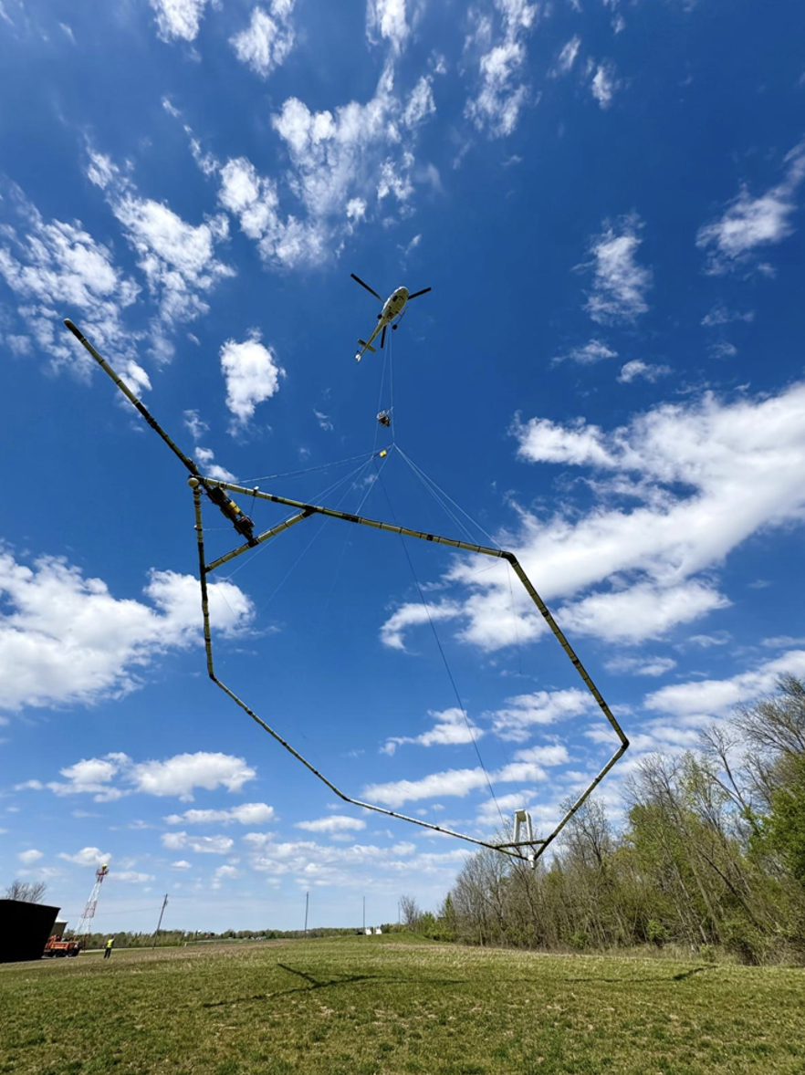
A low-flying helicopter towing a geophysical device collects scientific data on groundwater and geology. (Credit: SkyTEM Canada Inc.)